Labels

holiday (104) overseas (101) australia (97) victoria (90) 4wd (83) friends (56) europe (53) food (49) history (48) camping (46) river (45) southeast asia (44) sculpture (34) church (29) bird (28) temple (26) market (25) angkor wat (20) restaurant (19) train (19) lake (18) art (17) drink (17) high country (17) vietnam (17) wildlife (17) castle (15) fountain (15) hiking (15) France (14) Italy (14) Roman (14) boat (14) united kingdom (14) bridge (13) flower (13) monk (12) queensland (12) waterfall (12) England (11) cat (11) fishing (11) mine (11) roadtrip (11) ruin (11) culture (10) dog (10) palace (10) snow (10) burma (9) cave (9) garden (9) laos (9) medieval (9) music (9) cambodia (8) lizard (8) london (8) mountain (8) myanmar (8) New Zealand (7) North Island (7) alpine national park (7) buddha (7) busker (7) desert (7) goat (7) handcrafts (7) mallee (7) museum (7) snake (7) toolangi state forest (7) water buffalo (7) Germany (6) Uzes (6) huts (6) owl (6) Austria (5) Bavaria (5) Garmisch (5) Rome (5) Switzerland (5) big river state forest (5) children (5) plane (5) sunset (5) war (5) Barcelona (4) Florence (4) Lake Como (4) Paris (4) Salzburg (4) Spain (4) aboriginal (4) art gallery (4) cathedral ranges (4) craigs hut (4) duck (4) ha long bay (4) harry potter (4) horse (4) mekong (4) nsw (4) tudor (4) tunnel (4) volcano (4) wallaby (4) Annecy (3) Carcassone (3) Edinburgh (3) Ludwig (3) Maori (3) Montmartre (3) Scotland (3) Sound of Music (3) Sun King (3) Taupo (3) Venice (3) beach (3) bunyip state forest (3) elephant (3) furnicular (3) geocaching (3) geyser (3) goulburn river (3) inle lake (3) kangaroo (3) luang prabang (3) mitchell river (3) mt terrible (3) murrindindi state forest (3) otways (3) pig (3) relic (3) saigon (3) sheep (3) thailand (3) vientiane (3) wombat (3) wombat state forest (3) yangon (3) Bath (2) Bay of Islands (2) Cotswolds (2) Grindelwald (2) Ta Prom (2) Warrumbungles (2) amelie (2) cairns (2) carnavon gorge (2) cow (2) crooked river (2) dance (2) eagle (2) eildon state forest (2) enoch point (2) fish (2) flowers (2) goanna (2) ha noi (2) ho chi minh (2) hue (2) jamieson river (2) latrobe river (2) macaron (2) marysville (2) monkey (2) pakse (2) puppet (2) snowy river (2) upper yarra reservoir (2) warburton state forest (2) Auckland (1) Banteay Kdei (1) Baphuon (1) Bayon (1) Cambridge (1) Canterbury (1) Eastern Mebon (1) Hobbiton (1) Liechtenstein (1) Louis (1) Mt Ruapehu (1) Phimeanakas (1) Pre Rup (1) Preah Khan (1) Rotorua (1) Tonle Sap (1) Vatican (1) Waitangi (1) airshow (1) architecture (1) bagan (1) bangalore (1) bangkok (1) barrier reef (1) bear (1) beechworth (1) burger (1) cabaret (1) cat ba island (1) cattle (1) cemetery (1) coffee (1) craft (1) dingo (1) echidna (1) emu (1) festival (1) frog (1) gliders (1) glow worm (1) gold (1) grampians (1) gypsy (1) hoi an (1) india (1) jet boat (1) king river (1) kinglake (1) koala (1) leeches (1) linga (1) mandalay (1) marble (1) massage (1) mekong delta (1) military (1) mossman gorge (1) mynamar (1) mysore (1) ninh binh (1) nun (1) ocean (1) possum (1) purple citadel (1) rainforest (1) rangoon (1) rubber (1) rubicon state forest (1) scam (1) scone (1) sheepyard flats (1) siem reap (1) tiger (1) werribee gorge (1)

Monday, 27 December 2004

Mitchell River


Christmas New Year break again! The perfect opportunity to jump in the car and get away for a few days. I thought this year I'd go for a bit of a theme, and follow the Snowy River up into the High Country in Far East Gippsland.
First stop was Mitchell River. We pulled up at the car park for the Den of Nargun, but decided to leave the walk for latter. We continued to Lookout Point, where we set up for lunch, with a slight drizzle coming down.
We drove along Mitchell River Track, an easy 4WD track which took us across Cobbannah Creek (a very shallow crossing).


We caught some tantalising views of the cliffs along the Mitchell River through the trees as we continued towards a prospective campsite. The track also offered us some scenic vistas as it weaved closer to the river.


A promising spot by the riverside was already taken. In fact the people in this campsite had setup right on the track. It was a great spot near a ford of the Mitchell River, and we gingerly drove through the campsite, just missing their fire as we went on to explore the other side of the river. Over the river there weren't any really suitable spots, so we returned and continued on up to Angusvale.


Angusvale is a very large grassy flat on a wide sweeping bend of the Mitchell River. The area can accomodate hundreds of campers, but only a few choice spots exist along the river. We were fortunate to find one empty, except for a small car parked to the side. We decided to setup, and the kids were soon in the water.


It wasn't exactly a hot day, and some light showers continued to fall, but there was no way these kids weren't going to be in the water!


We relaxed around the campsite the rest of the afternoon, playing some totem tennis and taking it easy. There was a little more rain, but we had the tarp set-up and were well prepared for a wet weather camp.

Saturday, 13 November 2004

Cathedral Ranges Walk

The forecast was hot. Damn hot, but thankfully the weather was mild to warm up at the Ranges. The trip notes classified this as a hard walk, and hard it was. In fact it wasn't really a walk at all to start off with; more of a scramble and climb.


The walk could be broken into three parts. The first part was the climb to the summit of Mt Sugarloaf via Wells Cave, which we commenced at about 10:40am. As I said, it was more a climb than a walk. The notes indicated a 30 minute walk, but we were scrambling up sheer cliff faces, and swinging off trees through and up craggy rifts.


We eventually passed through the cave giving this track it's name; a long and dark crevass that we had to squeeze through, pushing our daypacks ahead of us. Lucky none of us were too portly as the final part of the cave required sliding through sideways to fit.


One hour into our 30 minute walk and we were finally at the summit at 11:40, less two of our original party. No, they didn't fall off a cliff, it was just that they expected more walk than climb. The views from the top were spectacular and the timing was just right for lunch.


After half an hour resting and eating, the walk proper started. We followed the Razorback from Sugarloaf to The Farmyard. This was a beautiful walk; not too hard and with great views and some easy climbing over rocky outcrops.


The track descended after the Butresses through young forest and down to The Farmyard where we took a short break. The walk was marked as two hours, but we had completed it in 1 hour and twenty, making up some time from the Wells Cave climb.
The Farmyard is named such as the Lyrebirds in the area reportedly imitate the sounds of the stock from the Archeron Valley below.


With the second portion of the walk completed , we made our way down Jawbone Creek Track, passing a number of Lyrebirds along the way.


Jawbone Creek track was quite steep, our toes getting squashed into the fronts of our shoes as we made our way down past Jawbone Creek, which borrowed our path along it's way down the gully.


We made up time to arrive at the carpark on schedule, tired but pleased with an excellent walk.

Saturday, 6 November 2004

Craigs Hut

Participants: Nidhi, Sampath, Pavan, Bhaskar, Suresh, Praveen & Mark


We departed from the city pretty much on plan; everybody being picked up and on our way about 8:00am with beautiful clear blue skies. We took the more scenic route as opposed to the fastest route, driving out via Healesville where we stopped for some last minute supplies and then winding our way across the Black Spur. The plan was to stop in Fernshaw for morning tea, but for some reason the place was locked up so went to Plan B and stopped at Dom Dom Saddle.
The instant we were out of the car we were greeted by a Magpie with his young chick, both very keen for food, and both also very adept at catching any food thrown at them.
We drove out through Eildon and climbed up and along Skyline Road, which offered some scenic views back into the Goulburn Valley as well as across over Lake Eildon which was much higher than my previous recent trips. We spotted a couple of Wedgetailed Eagles soaring over the ridge top and pulled over at a lookout to get some photos of the views across the lake.


The road then took us down to the lakeside where we got caught up behind some cyclists. We pulled over to take some more photos as the views were very scenic with the water so high and the clouds rolling across the valley; so far the rain forecasted had held off.


We stopped in at Mansfield and the bad weather chasing us from Melbourne finally caught up. It briefly hailed and then cleared up again as we drove out of Mansfield towards Mt. Buller.
We headed up towards Mt Stirling, passing a cyclist who had an extremely long and arduous climb ahead of him! Off to the right we had some views of Mt Buller, which still had some snow cover. Pavan had not previously seen snow so we were hopeful of coming across some today.


We drove down to Pineapple Flat on the King River, and the river was noticably higher and faster flowing than it had been on my previous visits. A quick chat with some people parked on the bank indicated that some other cars had recently crossed so we drove in and through the river, with water coming up over the bonnet we made it to the otherside where we setup for lunch.
The rain held off long enough for us to setup the tarp and picnic, and came down quite heavily as we sat under the tarp enjoying our lunches.


Soon after lunch the clouds cleared away again and we went for a short walk along the King River, with numerous wild flowers in bloom and the sun shining again.
The original plan for this trip was to drive along King Basin Track and up the Staircase to Mt Speculation and Lake Cobbler, but since the river was higher than normal and the rain had been falling heavily I decided against the 10 or so river crossings and the likely slippery Staircase climb that path would take us on. Additionally, Pavan hadn't seen snow before so I expected that going up to Craig's Hut would give us the highest probability of seeing some snow falling.


We drove out across King River again, and a few more times as well to get some good photos and then headed up to Mt Clear to visit Craigs Hut.


We arrived at Craig's Hut with the most beautiful views across the mountains with large fluffy white clouds rolling across the sky. There was a light dusting of snow as well, so Pavan received his wish!


We spent about 10 minutes enjoying the views and taking photos when almost instantly the views vanished as the mountain clouded over. An icy wind picked up and a light snow began falling. We sheltered in Craig's Hut from the wind and snow, enjoying the warm fire that was a new edition from our last visit.


The snow soon stopped falling and a lovely rainbow appeared near Mt Speculation.


A large group of trailbike riders arrived at the hut just as we were leaving and followed us as we continued on towards The Monument. We drove down Monument Track, which was very rocky in some places, and much rougher than my previous visit.


We stopped off at Bindaree Falls which was in good flow and then drove down to Bindaree Hut for afternoon tea.


We had a nice hot chocolate which was very welcome and warming before our long (very long) trip back home.
We drove along Upper Howqua Track then climbed out of the Howqua Valley along 16 Mile Jeep Track. This was reasonably steep and wet, though we made it out without any problems. We even spotted a few wallabies along the way.
Corn Hill Logging Road which climbs up to Mt Buller looks like a quicker exit from here but I'd like to check it out under drier conditions. It is marked as Management Only on the CFA maps though looking now on the Parks Website it is a seasonal closure track, and requires a crossing of the Howqua River as well as a steep climb with a number of switchbacks. Still, it's one to keep in mind for future trips.
So we continued up Bluff Link Road and out of the Valley at Refrigerator Gap where the mobiles were all working again. A few calls back to those waiting for us in Melbourne before heading out of the bush along Bluff Link Road, Brocks Road and then through Sheepyard Flat. On through Mansfield and Yea, we caught sight of the city lights past Whittlesea and had everybody dropped off home before 10:30PM.


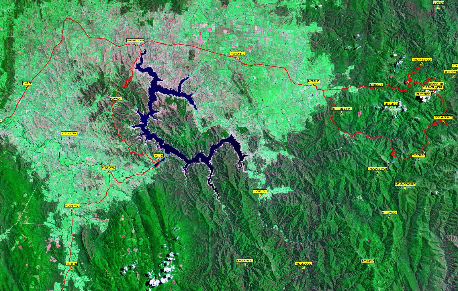
Click here to see a satellite image of our travels. Note, large image(563KB).

Track Summary & Travel Times

Track NameSurfaceTravel TimeTotal DistanceAvg SpeedMin AltMax Alt
Healesville to EildonHighway1 hour 15 minutes80km64km/hr97 metres524 metres
Eildon to Bonnie Doon (Taylors Road)2WD Gravel, beautiful views over Lake Eildon1 hour 2 minutes39km38km/hr234 metres651 metres
Mansfield to Pineapple FlatHighway/4WD Easy - Deep river crossing of King River1 hour 38 minutes58km36km/hr331 metres1351 metres
Pineapple Flat to Craig's Hut4WD Easy51 minutes33.9km40km/hr668 metres1462 metres
Craig's Hut to Monument Track4WD Easy8 minutes1km7km/hr1458 metres1472 metres
Monument Track4WD Medium/Hard(Wet) Moderate descents, loose rocks and rock ledges16 minutes3.6km13km/hr1341 metres1534 metres
Bindaree Hut to Bluff Link Rd (Upper Howqua Rd/16 Mile Jeep Track)4WD Medium - some steep sections35 minutes16.3km28km/hr786 metres1288 metres
Bluff Link Rd to Sheepyard Flat2WD Gravel44 minutes32.2km44km/hr557 metres1297 metres
Howqua Track (from Sheepyard Flat)2WD Gravel20 minutes16.8km50km/hr513 metres576 metres

Tuesday, 2 November 2004

Crooked River Cup Weekend 4WD and Camping Trip

Well today was the end of our holiday, so time to pack up camp and start heading home. Our Tongariro Travel Bug had gone missing, last seen around James' neck the evening before so we spent some time searching around the campground unsuccesfully. Hoping he was already packed away in a bag somewhere we made our way downstream (and through stream) for the last time.
Henric was waiting at one of the river crossings to get some photos, so I thought it a bit of a laugh to drive up close and splash a little water towards his car. I completely misjudged, and sent a large wave of spray through his open driver's window. Ooops, sorry for that. Henric was quite good natured as he wiped the water off his phone, GPS, dashboard, etc...
We had one last view of Billy Goat Bluff Track as we started on the scenic drive down the Wongangatta Valley to Waterford. We passed a number of nice campsites along the river worthy of a future visit, and I expect the fishing here would be quite good.
The drive home was quite straight forward, though the rain came down well and truly just after we had stopped for lunch.

I had long planned of travelling to the Crooked River, and did thoroughly enjoy my visit here. This was a great place to stay, especially at this time of year when it was not too hot. I look forward to coming back here and exploring further at some time in the future.

Monday, 1 November 2004

Crooked River Cup Weekend 4WD and Camping Trip

We woke up to a morning where we didn't have to worry about packing up camp and jumping into the cars for a days driving. Lovely and relaxing, well except for Henric who couldn't sit still. I went down to the river and had a refreshing sit in the cool waters. Michelle also had a wash and felt quite civilised.


Cory cooked us all up the best, fluffiest pancakes and James and I went for a walk around the campsite, looking and finding a number of mineshafts dug into the hillside. There was even one right by the campside travelling into the hill beneath our tents!


Late morning we decided to take a drive up to Grant. We continued up the Crooked River Track to Stonewall and climbed the very steep and narrow Bulltown Spur Track. Another convoy was travelling down the track, and somehow managed to find a slightly wider portion of track to sit on, perched over the sheer drop into the valley, to allow us to continue up and past them. The track joined up with McMillan Road, a good quality 2WD road which we followed into Grant.
Grant was a large cleared area on the top of the hill, with signs (some with photos) marking out where the various buildings had been during the town's heyday. It was amazing to think of this large township perched on the hilltop in such hard times, now easily accessable via 4WD.
We drove out to the Jeweller's Shop Mine, which was full of water. I'd left my waders at home, not that I'd really considered walking into the old mine shaft. The picnic ground near the mine was very pretty with blossoming fruit trees and we were about to set-up for lunch when we could hear the rumbling of thunder. Not wishing to have to drive down the steep roads we'd climbed in pouring rain we postponed lunch and drove around the the cemetary.
The cemetary visit was quite rushed as the thunder grew in intensity and regularity. Looking at the map, McMillan Road continued back down to Talbotville, so hoping that it was the same quality all the way down as the short section we drove on we headed back to Summer Hill. The rain was now coming down quite solidly, and we had no intention of driving down Bulltown or Collingwood Spur Tracks when they were wet.


Luckily, McMillan Road was quite safe and well graded and we arrived back in Talbotville as the rain started easing off. We visited the cemetary here, and also a nearby geocache, and set-up for lunch on the grassy flats by the Crooked River. The crowds of people from the day before all mostly having moved on.


We returned back to the campsite, again making the multiple river crossings. If you like driving through river crossings, then this is the place to visit. Also if you like old mining towns and looking for old gold mines, again this is your place to go. There were multiple mine shafts right alongside the road, and many I'm sure, off in the bush.
Everybody was happy to relax around the campground for the afternoon so I had no takers for my offer to walk to the New Good Hope Mine site. So off I went by myself. The climb up the walking track was remarkably steep. As I approached the tailings from the mine, I could see the old steam powered battery sitting where it was left some 94 years ago. The mine itself was no longer visible, with the shaft entrance having collapsed and now being overgrown.


I made my way back down to the car and returned to camp where we relaxed (well, everybody did except Henric who still couldn't sit still). Henric cooked up the most fantastic roast lamb with all the trimmings in the camp oven; the culinary highlight (closely followed by the aforementioned pancakes) of the trip. We sat around the campfire into the evening while the kids watched 'All Aussie Adventures on the laptop' There had been a light rain through the evening, though the tarp kept us all comfortable. Not long after midnight, a thunderstorm sewpt through the valley and I fell back asleep to the sounds of pouring rain on the tent.


Track Summary & Travel Times

Track NameSurfaceTravel TimeTotal DistanceAvg SpeedMin AltMax Alt
Bulltown Spur Tk4WD steep ascents, sharp switchbacks15 minutes2.9km12km/hr414 metres866 metres
Bulltown to Grant (inclusive of above)4WD steep ascents, river crossings, sharp switchbacks29 minutes8.4km18km/hr3854 metres1169 metres
Grant to Talbotville (McMillan Tk)2WD Gravel20 minutes9.9km30km/hr388 metres1199 metres

Sunday, 31 October 2004

Crooked River Cup Weekend 4WD and Camping Trip

There was no rush in the morning so we took our time and cooked up a hearty breakfast of Bacon, and Eggs in toast. There was heaps of firewood left over from Henric's efforts with the chainsaw (does he ever sit down and relax?) so we decided to load it all up on the roof, not being sure of how much would be available at our next planned campsite. Mindful of how long it had taken us to travel the previous day, and wishing to get to our planned base camp on the Crooked River at a reasonable time without driving all day, I decided to abandon the plans to drive up Mt Margaret and the visit to the Chromite Mine. It was a hard decision to make, but I felt it in the best interest of all involved. Anyway, it left something for the next time we were down this way.
We were soon enough all packed up, despite pleas to just camp here for the rest of the weekend, and had crossed the Barkly River and were climbing out of the valley. The views across to the red rocky outcrops, so typical of this area were stunning but avoided any decent capturing in my photographs.


We continued down Glencairn Road into Licola, passing a very crowded campsite on the Barkly, and a herd of cattle who enjoyed the fantastic views at Primrose Gap.
A leisurely fuel, toilet stop and icecream break in Licola and we were on our way up Tamboritha Road.
We passed a Tiger Snake on Moroka Road, who quickly made his way into the scrub at the roadside as we sat in the car watching him, and we then made a short stop while Henric readjusted the load of logs we collected from the first campsite. The logs were proving to be a little troublesome.


From McFarlanes Saddle we turned off Moroka Road onto Mt Wellington Track. The road meandered down through newly regenerated forest from previous years logging and crossed a small crystal clear creek before winding up the base of Mt Wellington.


The time was passing quickly, and the reality of an early arrival at the campsite was at best most unlikely. The trip across Mt Wellington was however worth every second. Again, that pink hued rock was everywhere; both on the tracks where we drove as we climbed to Wellington's Peak, as well as in the weathered rocks at the sides of the track.
The views from the summit were endless, with azure blue sky with brilliant white clouds fading into distant hills of multiple shades of blue. We spent quite some time enjoying the summit; Henric even trying out a little rock climbing!


We decided to continue on to the Sentinels, given that we were pretty well mostly there and it was unlikely we would be making the trip across Mt Wellington for a long time to come. The journey to the end of the track near Gables End took us past Miller's Hut with a few fewer logs on the top of Henric's car, and one too many on the car bonnet. We eventually arrived at the start of the walking track to the Sentinels, where we set up for a late lunch.
Liam managed to catch himself a giant grasshopper, and the boys and Michelle stayed at the carpark to try out some watercolour painting while Cory, Henric and myself set off on the short walk to the Sentinels.


The walk was reasonably easy, with a little scrambling over rocks after we had dropped down into the saddle. The last part heading out onto the Sentinels was quite heart-thumping, with rock crevasses with sheer drops and magnificent views down to Lake Tali Karng; very much worth the walk!


With a long way still to go to the campsite, and the afternoon quickly escaping us, depsite the overnight introduction of Daylight Savings, we retraced our steps across Mt Wellington. We did afford the luxury of visiting Miller's Hut before continuing across the summit back to Moroka Road.


We raced along Moroka Road through some very beautiful treed alpine countryside, bypassing the Pinnacles which we had seen on our previous trip, due to time limitations. We were soon at the top of Billy Goat Bluff Track, one of the famous must do tracks of this region. The track appeared graded since our last visit a couple years ago, but was still a thoroughly enthralling drive with some really steep sections and endless and unforgettable views down into the Wonnangatta Valley. The track descends from the great heights of the Moroka Plateau into the Wonnangatta Valley in a relatively short distance and was just as enjoyable travelling down as it was a few years ago driving up.


After much downward travelling, we arrived at the Wonnangatta River, which we followed downstream to Kingwill Bridge. The road to Talbotville closely hugged the impossible space between the cliffside and the Wonnangatta River then rolled across the gentle hills near the old Crooked River School site, and then following the course of the Wongungurra River where we had the first of many river crossings to reach our camp.
We crossed the Wongungurra River at least four times before branchng off and following the Crooked River further up the valley. There were 2 more river crossings over the Crooked River before we arrived at Talbotville, which we dubbed Tent City.


The place was crowded so we continued up the Crooked River in search of a quiet private campsite with river access.
We were starting to get quite desperate as darkness was falling and each small campsite along the river was already taken. Henric guarded the most promising of the poor pickings as we continued further upstream ever hopefull. There was a great crossing of the Crooked River where the exit track had actually become a small rivulet, but our mission beckoned.
Finally, with only moments to spare and little river still ahead of us we found a very nice empty campsite just past Bulltown. We called Henric over the radio to abandon the site he was "holding" and we set-up camp and sat down to Spaghetti Bolognaise for dinner.


Track Summary & Travel Times

Track NameSurfaceTravel TimeTotal DistanceAvg SpeedMin AltMax Alt
Rumpff Flat to Licola2WD Gravel1 hour 2 minutes28.8km28km/hr208 metres641 metres
Licola to Arbuckle Junction (Tamboritha Rd)Highway/2WD Gravel45 minutes46.7km62km/hr213 metres1485 metres
Arbuckle Junction to Wellington Tk exit(Moroka Rd)2WD Gravel22 minutes17.4km48km/hr1281 metres1499 metres
Wellington Tk (to summit)4WD35 minutes7.6km13km/hr1195 metres1652 metres
Mt Wellington summit to The Sentinels (Wellington Tk)4WD45 minutes9km12km/hr1385 metres1652 metres
Wellington Tk exit to Billy Goat Bluff exit (Moroka Rd)2WD Gravel25 minutes22.7km55km/hr1054 metres1275 metres
Billy Goat Bluff Tk4WD, some steep descents35 minutes8.3km14km/hr1416 metres328 metres
Kingswell Bridge to Talbotville (Crooked River Tk)4WD, numerous river crossings41 minutes14.9km22km/hr249 metres311 metres
Talbotville to Bulltown (Crooked River Tk)4WD, numerous river crossings36minutes7.4km12km/hr295 metres384 metres