Labels

holiday (104) overseas (101) australia (97) victoria (90) 4wd (83) friends (56) europe (53) food (49) history (48) camping (46) river (45) southeast asia (44) sculpture (34) church (29) bird (28) temple (26) market (25) angkor wat (20) restaurant (19) train (19) lake (18) art (17) drink (17) high country (17) vietnam (17) wildlife (17) castle (15) fountain (15) hiking (15) France (14) Italy (14) Roman (14) boat (14) united kingdom (14) bridge (13) flower (13) monk (12) queensland (12) waterfall (12) England (11) cat (11) fishing (11) mine (11) roadtrip (11) ruin (11) culture (10) dog (10) palace (10) snow (10) burma (9) cave (9) garden (9) laos (9) medieval (9) music (9) cambodia (8) lizard (8) london (8) mountain (8) myanmar (8) New Zealand (7) North Island (7) alpine national park (7) buddha (7) busker (7) desert (7) goat (7) handcrafts (7) mallee (7) museum (7) snake (7) toolangi state forest (7) water buffalo (7) Germany (6) Uzes (6) huts (6) owl (6) Austria (5) Bavaria (5) Garmisch (5) Rome (5) Switzerland (5) big river state forest (5) children (5) plane (5) sunset (5) war (5) Barcelona (4) Florence (4) Lake Como (4) Paris (4) Salzburg (4) Spain (4) aboriginal (4) art gallery (4) cathedral ranges (4) craigs hut (4) duck (4) ha long bay (4) harry potter (4) horse (4) mekong (4) nsw (4) tudor (4) tunnel (4) volcano (4) wallaby (4) Annecy (3) Carcassone (3) Edinburgh (3) Ludwig (3) Maori (3) Montmartre (3) Scotland (3) Sound of Music (3) Sun King (3) Taupo (3) Venice (3) beach (3) bunyip state forest (3) elephant (3) furnicular (3) geocaching (3) geyser (3) goulburn river (3) inle lake (3) kangaroo (3) luang prabang (3) mitchell river (3) mt terrible (3) murrindindi state forest (3) otways (3) pig (3) relic (3) saigon (3) sheep (3) thailand (3) vientiane (3) wombat (3) wombat state forest (3) yangon (3) Bath (2) Bay of Islands (2) Cotswolds (2) Grindelwald (2) Ta Prom (2) Warrumbungles (2) amelie (2) cairns (2) carnavon gorge (2) cow (2) crooked river (2) dance (2) eagle (2) eildon state forest (2) enoch point (2) fish (2) flowers (2) goanna (2) ha noi (2) ho chi minh (2) hue (2) jamieson river (2) latrobe river (2) macaron (2) marysville (2) monkey (2) pakse (2) puppet (2) snowy river (2) upper yarra reservoir (2) warburton state forest (2) Auckland (1) Banteay Kdei (1) Baphuon (1) Bayon (1) Cambridge (1) Canterbury (1) Eastern Mebon (1) Hobbiton (1) Liechtenstein (1) Louis (1) Mt Ruapehu (1) Phimeanakas (1) Pre Rup (1) Preah Khan (1) Rotorua (1) Tonle Sap (1) Vatican (1) Waitangi (1) airshow (1) architecture (1) bagan (1) bangalore (1) bangkok (1) barrier reef (1) bear (1) beechworth (1) burger (1) cabaret (1) cat ba island (1) cattle (1) cemetery (1) coffee (1) craft (1) dingo (1) echidna (1) emu (1) festival (1) frog (1) gliders (1) glow worm (1) gold (1) grampians (1) gypsy (1) hoi an (1) india (1) jet boat (1) king river (1) kinglake (1) koala (1) leeches (1) linga (1) mandalay (1) marble (1) massage (1) mekong delta (1) military (1) mossman gorge (1) mynamar (1) mysore (1) ninh binh (1) nun (1) ocean (1) possum (1) purple citadel (1) rainforest (1) rangoon (1) rubber (1) rubicon state forest (1) scam (1) scone (1) sheepyard flats (1) siem reap (1) tiger (1) werribee gorge (1)

Saturday, 19 July 2003

In search of the Wolfram Mine & Mt. Strickland

Mark & James

Keppel view over the valley of Marysville with Cathedral Range in the distanceJames and I set off early on Saturday morning in search of the Wolfram Mine, near Marysville. Wolfram is more commonly known as Tungsten, and is used in light filaments. I had seen the mine marked on one of my maps, and it had appeared easily accessible, with a 4WD track leading directly to the mine site.
After gathering some supplies, we made our way towards Marysville, turning onto Anderson Mill Road which ran along the ridge top before descending to an old mill site. There were no signs of an old mill site remaining, however there was still a lot of active tree milling occurring in this area. We were not able to find any remains of the timber tramway or other ruins that were marked on the map, so we investigated the Bicentennial National Trail camp site prior to driving up past Three Towers Lookout and onto Keppel Lookout were made a rest stop.
Keppel Lookout gave us views over the valley to Marysville, and on to the Cathedral Ranges in the distance. As we were enjoying the views, a pair of Wedge-tailed Eagles circled low overhead.

The track to Wolfram must be here somewhere...From Keppel Lookout we drove across the top of the range along Paradise Road past cleared areas around Mount Kitchener before descending to Wilkes Creek Road. The track here became quite steep and there was no sign of the side track to the mine. We drove up and down the track a number of times unable to find any indication that there was ever a track here, there being a quite steep drop-off from the side of the track which was quite thickly overgrown. We couldn't even see any signs of the building ruins that were marked on the map opposite to where the track should be. I decided to leave finding the Wolfram Mine to another day; perhaps approaching the mine along the creek bed, either upstream or maybe better heading downstream from Boundary Road where the approach seemed less steep and overgrown.
We continued down Wilkes Creek Road to the creek, but as the track onwards was quite wet and boggy and not suited to travelling without a companion vehicle, we backtracked and then continued on up to Mt Strickland.
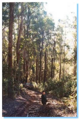
Coming out of the Woollybutts on the top of Mt Strickland was a cleared area covered in frost, and further on we came to a roadside puddle that was frozen over with tadpoles happily swimming beneath the ice.

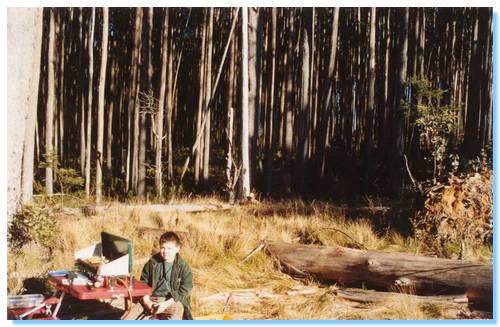
Lunch in the bush, what could be better?We passed Lowering Gear Track, which appeared permanently closed and soon came to a locked gate which marked the boundary of the water catchment area. We backtracked to the edge of a clear felled area, and set-up our lunch spot on a small sidetrack.
With Lowering Gear Track closed, we made our way down to the Acheron Way along a well constructed logging road which brought us out at the lower end of Lowering Gear. From here we explored up White Hill Track, which continued west as opposed to it's northward deviation as marked on the map. No sign of the north path remained, and our westward travel was eventually halted by a locked gate. The map also indicated a walking trail, which went on to Cleft Rock, but this was also elusive.
We backtracked to Acheron Way and caught up with White Hill Track where it was part of the National Bicentennial Horse Trail. The track climbed steeply to the top of the ridge where we travelled it for about a kilometre before deciding that the track was too wet and boggy. It would be an enjoyable drive with friends, but without a winch or another vehicle I decided to ere on the side of caution and leave this track for another day.

Friday, 4 July 2003

Higganbotham Mine

Mark, James & Liam

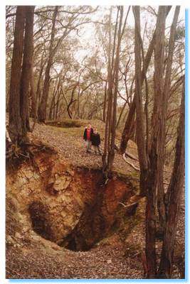
James and Liam looking into the air shafts and mine diggings
James, Liam and I were out on a boy's day, exploring the Black Range State Forest for old mining relics and sites.  After stocking up on food supplies, we headed along the same route as my previous trip to Higginbotham.

Getting our lunch fire started
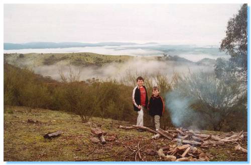
Exploring along Grant's Track, we investigated the old diggings on the top of the ridge above Higganbotham, before continuing to the end of the ridge, just before the track descends down to private property.  We stopped trackside, where we set-up for our BBQ lunch.  We got a small fire going on the top of the ridge, and kicked back to the magnificent views of the mist and low cloud blanketing the valleys.  Liam described it best, "It looks  like a huge bubble-bath, with the mountains peaking through like islands."

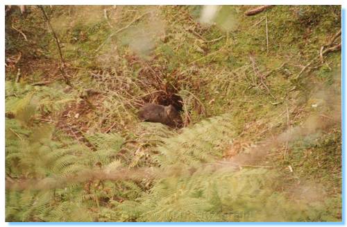
The suspicious wombat
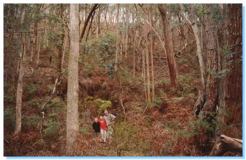
After lunch, we backtracked along Grant's Track and drove along the next ridge across on Beatsons Track, which brought us back to Grant's Track which descends steeply down in to the valley where the Higganbotham Mine is located.  The track branched off near the gate into private property backup along the valley, which we followed until we reached the first of many large gumtrees which had fallen down across the track.  We clambered over these trees to only be confronted with at least another 4 or 5 such obstacles across the track.  Looking across the creek to the other side of the valley showed numerous trees which had been either uprooted, or snapped and brought down.  It looked as though some mini cyclone had passed through the area.  As we continued along the path, we caught site of a wombat running through the bottom of the ravine.  He clearly knew there was somebody else down here with him, but he couldn't see where we were.  We watched him for a while as he sat outside his wombat hole, wondering what was going on.

Now, where is that damn mine????
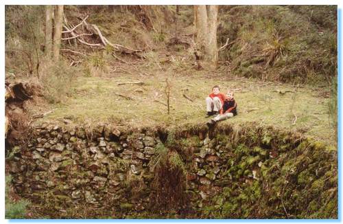
I had no real indication of what, if anything we would find; nor exactly where to look so we continued along the path where we eventually came to a hollowed out semi circular area, the walls of which were lined with stones.  Exploration further along found a square cut out flat, likely housing some machinery or a small hut.  I continued further upstream trying to locate the mine I believed was in the area, coming to a junction in the creek but still no sign of any shafts.  It was clear I was in the right area, and looking up to the top of the valley was what was pretty definitely the diggings we had explored earlier, but still no mine shaft.  I walked up some of the feeder creeks, climbing up the valley sides, which were strewn with tailings, a good sign I believed, but still no mine shaft.  Giving up in this area, obviously having travelled too far up stream we headed back to where the ruins where.

We found the mine, well sort of...
South of the stone circle, there was a small gully which I climbed along.  This was looking more promising with a significant amount of tailings.  I eventually came to the foot of a tailings heap, which I climbed up to find the shaft of the mine.  Well, it would have been the shaft at one time, however the entrance was completely caved in.  I called the boys up to have a look around; not what they expected, but at least we found it.

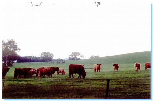
We made our way back down, and climbed over many fallen trees again on our way out.  We drove out north, via Limestone where we came across a paddock full of Highlander Cattle, including calves.  Magnificent!
Highland cattle

Monday, 9 June 2003

Cathedral Range Camping Trip - Queens Birthday Long Weekend

Mark & Liam

Oiyee

Mark

Shirley & Marty

Julia & Andrew

Saturday

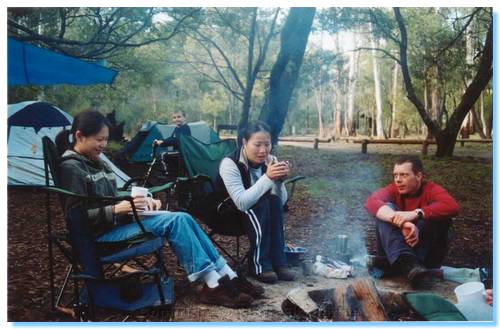
We arrived late on Saturday afternoon to a surprisingly packed campground.  I arrived first and setup the tarp between the trees and waited for Mark & Oiyee to arrive.  We setup our tents, and started preparing dinner, which as usual was a culinary feast.  Tonight consisting of Chinese Dumplings as an entree. followed by Lamb Curry with roti.  We had little luck getting any significant fire going, having only redgum timber and an extremely wet fireplace.  We enjoyed various cheeses and chocolate around our small fire before we retired to beneath the tarp to play cards into the evening.  A light drizzle continued through the night, resulting in Mark waking up wet in the morning due to a hole in his tent.  Oiyee and myself also woke up through the night to the sound of running water close to our tents.  We were both much relieved to find it was water overflowing from the tarp, and not what we first believed!

Sunday

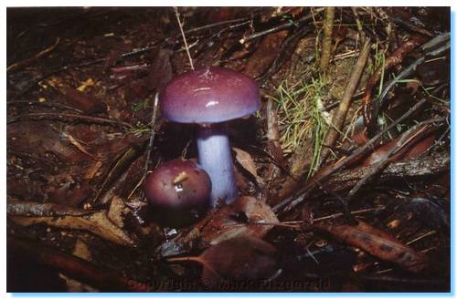
Purple toadstools!
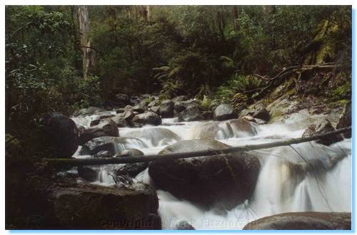
Warm porridge for breakfast and a relaxing morning whilst we waited for Julia and Andrew to arrive.  We all headed off for a walk upstream along Little River, which took us through a fern filled gorge.  The track was quite difficult to follow at some points, being unmarked with a slippery scramble down.

Little River
The area was very wet and green, with a vast assortment of fungi, toadstools and mushrooms growing along the track and on fallen logs and trunks.  We continued along the river for a kilometre, climbing over granite rocks and fallen trees, but it was evident we could not reach Little Falls and walk back out again in time for us to do our other planned activities for the day so we gave up going any further and headed back to camp.

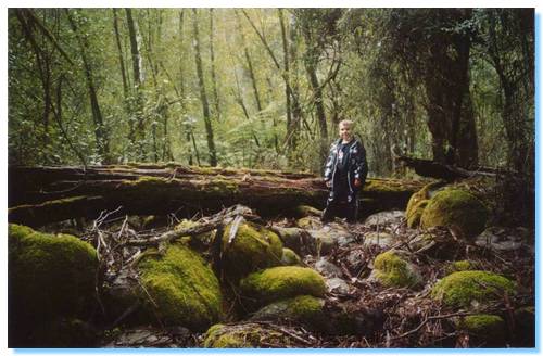
Liam on Little River Falls walk
The trip back out found Mark, Oiyee and myself all attacked by leeches.  A rather vicious one had attached itself to my neck, which Andrew most bravely pulled off.  The sound of a Lyrebird added a more peaceful and relaxing tone to the rest of the walk back to camp.
Lunch was left over dumplings and soup.  Shirley and Marty arrived in the afternoon and setup camp.  We left them to enjoy the campsite as we headed off to the Buxton Trout Farm to catch our dinner.  We caught 3 good sized Atlantic Salmon, 2 full of roe.  Liam caught the biggest fish of the day; so big that the line snapped and the fish got away!
We said our farewells to Julia and Andrew, collected some decent firewood and returned to camp to start the cookup.  We cooked the salmon in foil over the fire with ginger, garlic and lemon which I thought quite tasty.  We sat around the fire and chatted till late, gorging ourselves on cheese and chocolate again and then returned under the tarp to play cards till very late.

Monday

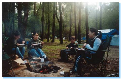
Breakfast around the campfire
No rain overnight, so we awoke to a reasonably dry campground.  Oiyee and Mark headed off for an early morning run, whilst I got the campfire going.  We had a huge bacon & egg breakfast, including Italian sausages, hash browns and baked beans.  Shirley and Marty had corned beef.  After breakfast, we relaxed around the campfire watching the kookaburras, currawongs and choughs before setting off for a walk downstream along Little River towards Ned's Gully.  There were some magnificent red toadstools with white spots among the pine trees, as well as the sounds of lyrebirds.

More breakfast around the campfire
We returned to the campsite for a relaxed lunch, before heading on home late afternoon.

Sunday, 18 May 2003

Wombat State Forest Range Rover Club Trip


Trip Leaders

Mike Farrow & Sermin Tanyeri

Range Rover

Participants

Neil Buttigieg

Discovery

John Cunning

Land Rover

Kwok Chan

Range Rover

Gareth Brown

Discovery

Mark Fitzgerald

Patrol

Tail End Charlie

Manole Ioannou

Patrol

Report: Mark Fitzgerald

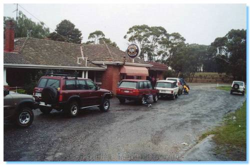
Mineral Springs Hotel before departure
We all met at the Mineral Springs Hotel, just short of Spargo Creek at 9:00, and after quick introductions, a run down on the convoy procedures, tyre deflations and a radio check we were off by 9:30.
We headed off the main road and were soon on the dirt, heading along Werribee Track, which was wet and only slightly rutted.  This track was of a reasonable standard, having a solid base and no clearance issues and was easily traversed in 2WD.  The track took us past a burnt area of forest which was set up as a Forest Effects Research Area.  Signs at each end indicated that this area of the forest was divided into 5 separate sections.  One area was left unburnt as a control and each of the other 4 areas were burnt at different set intervals.  From memory, one area was burnt every autumn & spring, one each year, one every 5 years and one every 10 years.  This was done to study the effects of fire on the forests regeneration.
At the end of Wombat Track, we turned right onto a 2WD gravel road and then turned left onto another track which took us past some farmland and up past Edwards Hill.  Again, this track was solid and posed no problems or challenges, being only slightly potholed, even though the track was quite wet from the days drizzle.  We drove past some recently logged areas, and areas signposted as being set aside for commercial logging as well as domestic firewood collection areas.
We took a right turn onto Mayhers Track, which soon started to climb with the track became rockier, prompting a precautionary recommendation to drop down to low range.  The track became in parts slightly overgrown; nothing too serious however with only some soft shrubs encroaching the track.  The track turned out to still be quite tame, having a solid base with a little water in some of the larger ruts.
From here we turned right onto a 2WD gravel road, which took us past Wombat Creek Road where it was getting quite misty and foggy.  We made our way right onto Leynards Hill Track, another 2WD gravel road then left, at a crossroads keeping us on Leynards Hill Track when the rain started to come down quite heavily.
We soon crossed a marker indicating the Great Dividing Range, with an elevation in the low 700s before turning right onto Post Office Track.  This track took us down to some more serious 4WDing.  We passed through some more heavily logged areas with the occasional Pink Heath along the track edge.  The track started to descend through some forest that didn't appear to have been logged for some time, the trees being much taller, thicker and denser than what we had passed earlier today.
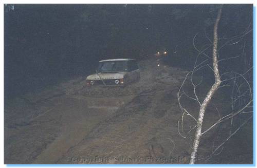
Passing through the bogholes
The track was becoming wetter, with a number of bogholes; none which gave us much trouble as they all had quite firm, solid bases.  A left turn into Paddock Track brought us to some more substantial bogholes.
Gareth got stuck in one of these bog holes.  Mike and myself listened on the radio to see what the hold up was, and returned back through a couple of bogholes to see if any recovery assistance was required.  Everything was under control, and John performed a snatch recovery of Gareth out backwards.  Gareth's front diff was hanging up on the top of the rut in the soft clay.  He was easily able to bypass the obstacle by straddling the ruts on the left hand side.
Two bogholes further on however proved far more disastrous, with Gareth getting well and truly bogged.  He ended up taking on a good bit of muddy water to the inside of his car before being snatched out.  Mike made it through without any serious problems.  I got stuck half way through where the bottom had become quite soft and had to use both front and rear diff-locks to reverse back out and try it a bit faster; making it through.  John gave it an unsuccessful go, and I was able to snatch him out forwards, while the rest of the group drove around this one.
A number of other bogholes along this track were all passed without incident or need of recovery, as we continued through the mist shrouded gums.
We stopped for a late morning tea near an old rundown bridge.  The bridge ran across a steep railway cutting, which at one point in the past the rail line to Daylesford passed through.  Now it appeared to be a dumping ground for stolen and abandoned cars.  A track ran up and around a nearby graded mound, providing a very steep section which a number of us practised ascents and descents on before we all pulled up for a warm coffee and snacks.
After our tasty beverages, we were all back in our cars descending  a steepish track alongside the gas pipeline.  Climbing up the other side brought us to some more heavily logged areas, with the ubiquitous logging tracks meandering in all directions, many of which we took before finding ourselves on a track that seemed to have more trees growing on the track then along the sides of it.  A bit more backtracking and we were heading in the right direction, giving all of the cars an opportunity to show-off their turning circles.
We passed even more logged areas, where the track was well graded and covered in crushed rock as it was likely used by the logging trucks; but it soon became rougher.  We descended steeply into a lovely valley through some thick forest; the muddy boghole at the bottom of the valley had a small steep exit, but everybody made it through with no dramas.
We were now driving on the other side of the logged areas, and the track had become quite slippery.  There was a layer of wet clay on the track surface which clogged the tyre treads.  Kwok felt this the most, having to make a number of attempts around a sharp corner as he was running road tyres.  Everybody else with All Terrains or more aggressive got around the corner without problems.
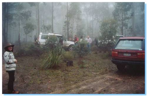
Lunch time in the mist
We then arrived at our lunch stop, where we relaxed, ate and chatted until 2:15 when we packed up and departed as a light drizzle began to fall.  We turned right onto a 2WD gravel road alongside a clear felled logging area, and surprisingly at this late hour it was still quite foggy.
Turning left down Batson Still Track took us through some very scenic forest, which included a clear grassy area surrounded by trees which would make a good campsite.  There were a number of muddy patches, but the track was quite firm and not slippery and easily driven in 2WD.
We came out of the forest into farmland and private property, passing a number of very old rusting cars and truck bodies.  Before we knew it we were back at the Hotel, pumping up tyres, and giving our farewells and thanks to Mike before returning home.

Tuesday, 22 April 2003

Great Ocean Road, Mt Eccles and Mt Gambier Region

Thursday

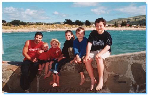
Shannon, Liam and James at Apollo Bay
Clarke, Jared, Emily, Shannon, Liam & James at Apollo Bay
The first part of this holiday was an extended family holiday in Apollo Bay.  We rented a unit in the back of Apollo Bay which served as our base and we had a relaxing 4 days exploring Apollo Bay, relaxing on the beaches, visiting the craft market and also exploring some of the Otway National Park.
James spotted a penguin playing in the swell off the jetty at the boat harbour one evening, which he was quite chuffed about.

Friday
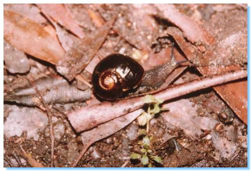
Rare Otways Black Snail
We also went on the Mait's Rest Rainforest walk where we spotted an unusual black snail slithering across the path, which we lifted up and placed in the bracken at the path edge to protect him from being trodden on.  An information sign further on indicated that this was a rare Otway Black Snail, so we wandered back up the trail in search of the snail for a photo!
We also drove along the Barham River Scenic Drive, and came to Paradise Point, which is a magical picnic location on the river, with tables under the tall tree ferns.  We came back here after dark and saw a number of glow worms on the embankments of the path edges, which the kids, and the adults thought fantastic.
We also drove along some of the back country roads behind Apollo Bay, where we enjoyed some great views of the rolling hills, ocean and rainforest, and Liam and I walked along the rocks at Marengo to the incoming tide.

Saturday

Saturday Shazzy, Clark, Arthur & Glenda, Gards and myself went on a fishing trip with Moonlight Fishing Charters, where we fished for Snapper off the Lighthouse at Cape Otway.  The fishing wasn't too great, with only a few undersized Snapper and Flatties being caught, and a decent sized Blue Throated Wrasse that I caught.  We baked this for dinner, but it wasn't particularly tasty.  Though the fishing wasn't too great, the views and the boat ride where enjoyable, except for a couple others who suffered sea-sickness!

Sunday
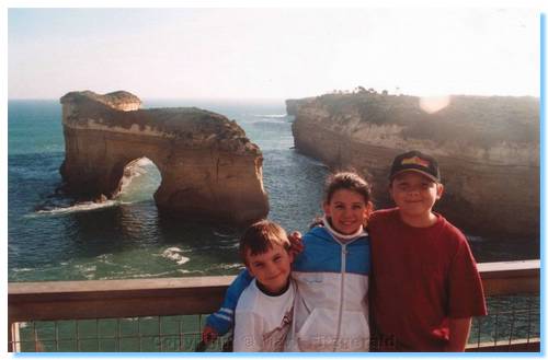
Liam, Shannon and James at Loch Ard Gorge
Sunday we had Easter lunch at the pub, and then Michelle, Sharon, Glenda, James, Liam, Shannon and myself drove along the Great Ocean Road to visit the Twelve Apostles and some of the other sites.  The Twelve Apostles was quite different to the last time we visited, some 15 years earlier, being very touristy now.  Gone is the small carpark on the side of the road and the dirt walking tracks meandering through the salty scrub; replaced with a large tourist information centre, hoards of tourists, landscaped paths and highway underpass and the constant thrumming of the helicopter joy flights.  We also visited Loch Ard Gorge and walked down on the beach, as well as the Thunder Cave and Blowhole.

On through to ANZAC Day

Monday

With ANZAC Day falling straight after Easter this year, it was the perfect opportunity for an extended break without using up much Annual Leave.
We said our goodbyes to all of the Tuffens, and Michelle, I and our kids continued onto the next leg of our holidays.
Our first stop was the lighthouse at Cape Otway, very historic with the lighthouse built in 1848, powered originally by whale oil, and the old buildings and various artefacts on display including the anchor from Eric the Red, a ship wrecked on the reef 3 kilometres offshore on it's way to Melbourne, laden with exhibits for an exhibition at the newly opened Melbourne Exhibition Buildings.
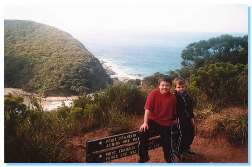
James and Liam at Parker Hill
After exploring the grounds, the views from the lighthouse and a nice morning tea at the cafe we set off exploring some of the tracks in the area for future campsites.
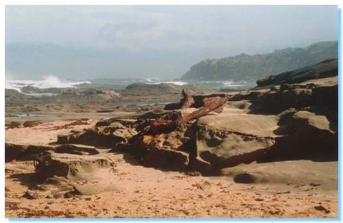
Anchor of 'Eric the Red'
There was a nice campsite at Parker Hill, near where the stone that the lighthouse and buildings was quarried.  There were toilets here, but the walk down to the beach was a very long way; still this was a nice sheltered camping site.  A better site close to the beach was at Crayfish Bay, but this lacked any facilities.  We spent some time here exploring the rock pools which were quite good, with a number of colourful pink starfish, glass shrimp, anemones, gobies and other critters spotted.  We also found the other anchor for the Eric the Red, embedded in the rocks!
We also drove down to Johanna Beach campground, which too seemed a very nice beach campsite with the added advantage of toilets.  No fires are allowed here, same as the other campsites along the coast.
Having seen a number of the sites along the Shipwreck coast the day before, we were able to drive past Port Campbell before our next stop, The Arch.  As well as viewing some scenic rugged coastline, there also was an echidna walking along the path!
From here we had to visit London Bridge.  The last time Michelle and I saw London Bridge it was still a bridge, so we had to see it with the collapsed arch.  All signs of the arch had vanished into the sea, and the kids were pretty impressed that we had walked on the new island, something I guess they will never be able to do.
Time was now running short.  We drove past the Bay of Martyrs and the Bay of Islands past Peterborough and headed into Warrnambool for fuel and food supplies.
We arrived at Mt. Eccles just before dusk and quickly had the tent set up.  A chat with another camper identified a farm house down the road where firewood could be purchased, so it wasn't long before we were relaxing around the campfire and entertained by Brush Tail Possums, as well as having a close encounter with a Boobook Owl!

Tuesday
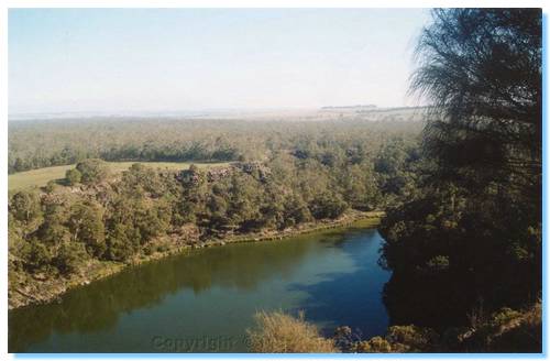
View of Lake Surprise from Mt Eccles Summit
Tuesday we woke to kookaburras and other bird calls, and after a campfire cooked Bacon & Eggs breakfast, we walked around the Mt Eccles crater rim and explored the lava cave, and the kids made some friends with some kids who camp at Mt. Eccles each Christmas and Easter.  Lunch was an easy cold meat and salad sandwiches amongst the Superb Fairy Wrens, who were totally oblivious to us, hopping around our feet through the campsite.  After lunch, we drove to the Natural Arch, a section of un-collapsed lava tube.
For dinner we roasted a chicken in the camp oven, which we are still getting the hang of.  A small chicken could easily be done in about an hour; while some of it and some vegies were overdone, it was still generally a very tasty roast dinner, and being prepared for the possums tonight we had some apple ready which they very much enjoyed.

Wednesday
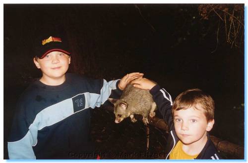
Feeding the possums at Umpherston Sinkhole
Wednesday we walked down and around Lake Surprise after another Bacon & Egg breakfast, spotting a koala and a number of other noisy kids on our way, then returned to camp to pack up and head to Mt. Gambier.
At Mt. Gambier, we explored a few lookouts before looking for a caravan park for the night, settling on Pine Country Caravan Park, in a comfortable cabin.  We cooked up a big BBQ dinner and then at dusk headed to the Umpherston Sinkhole to feed the friendly and cheeky possums.

Thursday
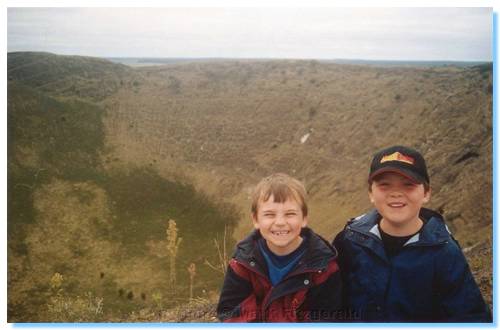
James and Liam on Mt Schank volcano
Thursday morning we circumnavigated Blue Lake, which was still a strong blue colour given the time of year, and also drove down into the other crater for a quick explore.  We then drove down to Mt. Schank, where James, Liam and I climbed the summit and descended into the crater to leave our mark.  From the crater rim, I had a magnificent close up view of a goshawk as it flew across the rim just metres in front of me.
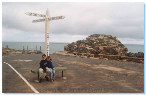
James and Liam at the Southern most point in S.A.
From Mt. Schank we continued on down to Port MacDonnell for some Fish & Chips, and a quick explore along the coast here.  We lunched on Shelly Beach, and the kids and I had a quick snorkel, though it was getting quite cold!  We also went to Port Northumberland, the southern most point in S.A. where we viewed the site of an old lighthouse, which was removed for fear of it collapsing into the sea.
From Port MacDonnell, we left around 2:00pm for our long drive home, arriving in Ballarat about 6:30 for dinner at Mum's and eventually getting home late Thursday night.
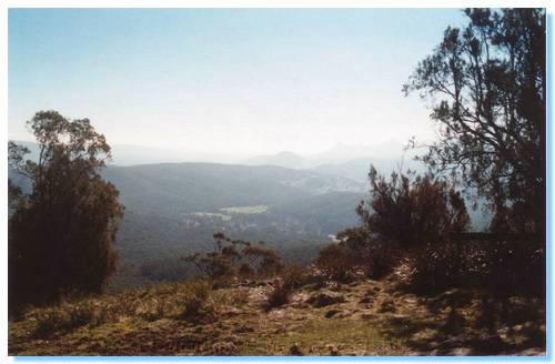
Sunday, 30 March 2003

Marysville & Keppel Hut

Beryl & Kurt
Mark, Michelle, James & Liam, Glenda & Arthur

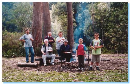
Keppel Hut Group Shot
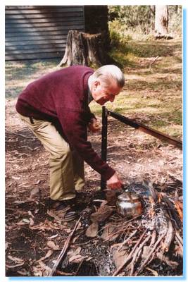
Kurt tending the billy
This was an easy one day trip into the forests behind Marysville.  After morning tea in the park at Marysville, we made our way down Lady Talbot Drive.  Taggerty River Fire Line Track no longer appeared to exist, so we travelled further along Lady Talbot and starting climbing White House Fire Line Track.  We didn't make it to the top however, leaving this track for another day and deciding to head directly to our lunch destination of Keppel Hut.

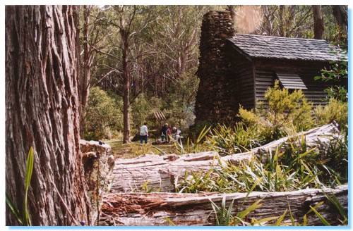
Lunch at Keppel Hut
We explored around the hut and ate our lunch around a warming fire before heading across the mud and along McFadyen Track.  This is a great 4WD track through some very beautiful forest areas.  It's not a hard track, but is still fun, with mud, rocks, bog holes and great and varied scenery.  I especially liked travelling through the Woollybutts, with the granite boulders strewn throughout.
From here, we made our way down Tweed Spur Road which had been graded and was quite different from the last time we travelled it.  We stopped for afternoon tea at Cooks Mill in the Cathedral Ranges, letting the kids enjoy a swim in Storm Creek before returning home.

Sunday, 9 March 2003

Alpine High Country

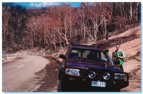
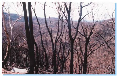
The purpose of this trip was to drive through the High Country of Victoria, and get some appreciation of the extent of the damage caused by the January/February 2003 fires that have burnt over 1.1 million hectares.
I picked up Mark at 7:00am and headed up the Hume Freeway to Wangarrata.  We then made our way towards Bright.  There were quite a few cyclists on the rail trail into Bright, and we could see the hills had seen some fire, with swathes of brown through the normally green eucalypts around Mt Buffalo.

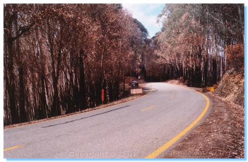
Bright itself was teeming with people.   We had a morning tea of sausage rolls from the Bakery, then continued our journey to Harrietville.  Very soon after making the steep climb up the Alpine Way out of Harrietville, we could see close up the effects of the fire.  All of the undergrowth was burnt, as well as the sides of the trees.  The trees themselves mostly still had their leaves, however these had turned to brown.  There were new leaves shooting from the sides of the trunks on most trees, and green grass and ferns were coming up from the ashes.  A number of the road signs had scorch marks, and some of the signs were buckled and had blistered paint, but the bush looked like it was already starting to recover.


As we approached Mt Hotham, we were able to see across the valleys and get a better idea of how far the fire had spread.  Mt Hotham itself also seemed to have had a pretty close call with the fire.   We travelled through Dinner Plains, and the story was the same, burnt tundra and some damage to the trees.  The closer we got to Omeo, however the worse it became, as the pictures attest.


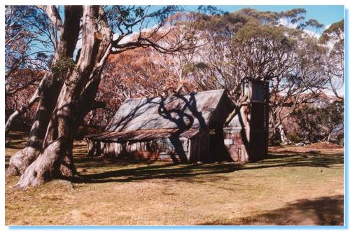
We drove back via the Bogong High Plains Road, stopping at Wallace's Hut to break the drive.  We then travelled through Falls Creek, and stopped for afternoon tea in Mt Beauty.  A quick fish at Mongan's Bridge, and then the long trip home was started.
It should be noted that the best way to make a long trip into a longer trip is to take a shortcut.  Wanting a different route to the freeway all the way back, it was decided to take a shortcut from Myrtleford down past Lake Buffalo, through Whitfield, Mansfield and back home.  This would have probably worked OK if the road across the dam wall at Lake Buffalo was open, but it wasn't.  Looking at maps there seemed to be a way through the bush on the Eastern side of Lake Buffalo, so after much exploring and backtracking we eventually found our way out of the dark forest at Dandongadale where we could then head on home through Cheshunt, Whitfield and Mansfield.
Though this short cut added an extra 3 hours or so to our trip, it could certainly not be called boring.  We also spotted a good collection of wildlife, including a Tawny Frogmouth, numerous wallabies and kangaroos, a few wombats, including a mother and baby.  And, unfortunately, a number of foxes and rabbits.  The road between Dandongadale and Cheshunt was the most prolific in regards to animals spotted.