Labels

holiday (104) overseas (101) australia (97) victoria (90) 4wd (83) friends (56) europe (53) food (49) history (48) camping (46) river (45) southeast asia (44) sculpture (34) church (29) bird (28) temple (26) market (25) angkor wat (20) restaurant (19) train (19) lake (18) art (17) drink (17) high country (17) vietnam (17) wildlife (17) castle (15) fountain (15) hiking (15) France (14) Italy (14) Roman (14) boat (14) united kingdom (14) bridge (13) flower (13) monk (12) queensland (12) waterfall (12) England (11) cat (11) fishing (11) mine (11) roadtrip (11) ruin (11) culture (10) dog (10) palace (10) snow (10) burma (9) cave (9) garden (9) laos (9) medieval (9) music (9) cambodia (8) lizard (8) london (8) mountain (8) myanmar (8) New Zealand (7) North Island (7) alpine national park (7) buddha (7) busker (7) desert (7) goat (7) handcrafts (7) mallee (7) museum (7) snake (7) toolangi state forest (7) water buffalo (7) Germany (6) Uzes (6) huts (6) owl (6) Austria (5) Bavaria (5) Garmisch (5) Rome (5) Switzerland (5) big river state forest (5) children (5) plane (5) sunset (5) war (5) Barcelona (4) Florence (4) Lake Como (4) Paris (4) Salzburg (4) Spain (4) aboriginal (4) art gallery (4) cathedral ranges (4) craigs hut (4) duck (4) ha long bay (4) harry potter (4) horse (4) mekong (4) nsw (4) tudor (4) tunnel (4) volcano (4) wallaby (4) Annecy (3) Carcassone (3) Edinburgh (3) Ludwig (3) Maori (3) Montmartre (3) Scotland (3) Sound of Music (3) Sun King (3) Taupo (3) Venice (3) beach (3) bunyip state forest (3) elephant (3) furnicular (3) geocaching (3) geyser (3) goulburn river (3) inle lake (3) kangaroo (3) luang prabang (3) mitchell river (3) mt terrible (3) murrindindi state forest (3) otways (3) pig (3) relic (3) saigon (3) sheep (3) thailand (3) vientiane (3) wombat (3) wombat state forest (3) yangon (3) Bath (2) Bay of Islands (2) Cotswolds (2) Grindelwald (2) Ta Prom (2) Warrumbungles (2) amelie (2) cairns (2) carnavon gorge (2) cow (2) crooked river (2) dance (2) eagle (2) eildon state forest (2) enoch point (2) fish (2) flowers (2) goanna (2) ha noi (2) ho chi minh (2) hue (2) jamieson river (2) latrobe river (2) macaron (2) marysville (2) monkey (2) pakse (2) puppet (2) snowy river (2) upper yarra reservoir (2) warburton state forest (2) Auckland (1) Banteay Kdei (1) Baphuon (1) Bayon (1) Cambridge (1) Canterbury (1) Eastern Mebon (1) Hobbiton (1) Liechtenstein (1) Louis (1) Mt Ruapehu (1) Phimeanakas (1) Pre Rup (1) Preah Khan (1) Rotorua (1) Tonle Sap (1) Vatican (1) Waitangi (1) airshow (1) architecture (1) bagan (1) bangalore (1) bangkok (1) barrier reef (1) bear (1) beechworth (1) burger (1) cabaret (1) cat ba island (1) cattle (1) cemetery (1) coffee (1) craft (1) dingo (1) echidna (1) emu (1) festival (1) frog (1) gliders (1) glow worm (1) gold (1) grampians (1) gypsy (1) hoi an (1) india (1) jet boat (1) king river (1) kinglake (1) koala (1) leeches (1) linga (1) mandalay (1) marble (1) massage (1) mekong delta (1) military (1) mossman gorge (1) mynamar (1) mysore (1) ninh binh (1) nun (1) ocean (1) possum (1) purple citadel (1) rainforest (1) rangoon (1) rubber (1) rubicon state forest (1) scam (1) scone (1) sheepyard flats (1) siem reap (1) tiger (1) werribee gorge (1)

Sunday, 9 March 2003

Alpine High Country

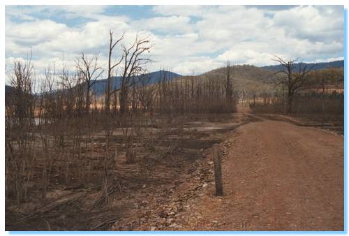
The purpose of this trip was to drive through the High Country of Victoria, and get some appreciation of the extent of the damage caused by the January/February 2003 fires that have burnt over 1.1 million hectares.
I picked up Mark at 7:00am and headed up the Hume Freeway to Wangarrata.  We then made our way towards Bright.  There were quite a few cyclists on the rail trail into Bright, and we could see the hills had seen some fire, with swathes of brown through the normally green eucalypts around Mt Buffalo.
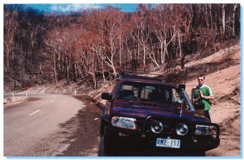
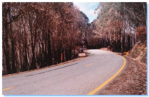
Bright itself was teeming with people.   We had a morning tea of sausage rolls from the Bakery, then continued our journey to Harrietville.  Very soon after making the steep climb up the Alpine Way out of Harrietville, we could see close up the effects of the fire.  All of the undergrowth was burnt, as well as the sides of the trees.  The trees themselves mostly still had their leaves, however these had turned to brown.  There were new leaves shooting from the sides of the trunks on most trees, and green grass and ferns were coming up from the ashes.  A number of the road signs had scorch marks, and some of the signs were buckled and had blistered paint, but the bush looked like it was already starting to recover.
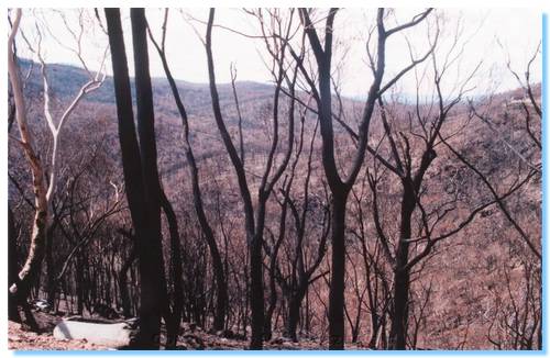

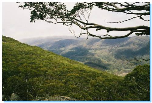
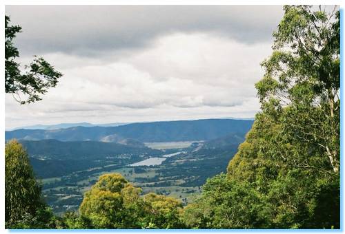
As we approached Mt Hotham, we were able to see across the valleys and get a better idea of how far the fire had spread.  Mt Hotham itself also seemed to have had a pretty close call with the fire.   We travelled through Dinner Plains, and the story was the same, burnt tundra and some damage to the trees.  The closer we got to Omeo, however the worse it became, as the pictures attest.
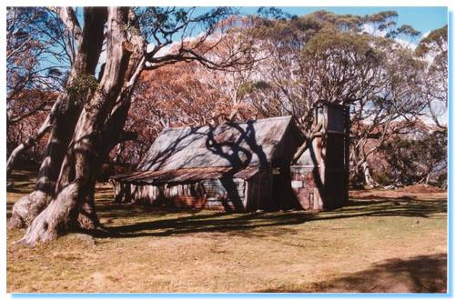

We drove back via the Bogong High Plains Road, stopping at Wallace's Hut to break the drive.  We then travelled through Falls Creek, and stopped for afternoon tea in Mt Beauty.  A quick fish at Mongan's Bridge, and then the long trip home was started.
It should be noted that the best way to make a long trip into a longer trip is to take a shortcut.  Wanting a different route to the freeway all the way back, it was decided to take a shortcut from Myrtleford down past Lake Buffalo, through Whitfield, Mansfield and back home.  This would have probably worked OK if the road across the dam wall at Lake Buffalo was open, but it wasn't.  Looking at maps there seemed to be a way through the bush on the Eastern side of Lake Buffalo, so after much exploring and backtracking we eventually found our way out of the dark forest at Dandongadale where we could then head on home through Cheshunt, Whitfield and Mansfield.
Though this short cut added an extra 3 hours or so to our trip, it could certainly not be called boring.  We also spotted a good collection of wildlife, including a Tawny Frogmouth, numerous wallabies and kangaroos, a few wombats, including a mother and baby.  And, unfortunately, a number of foxes and rabbits.  The road between Dandongadale and Cheshunt was the most prolific in regards to animals spotted.

Sunday, 23 February 2003

Eildon & Darlingford

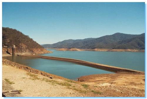
This was an exploratory trip to see how low Lake Eildon was, and also to see some of the old ruins that may have been uncovered by the receding lake waters.
I drove up to Eildon Dam where the original dam, Sugarloaf was quite exposed.  A 4WD access boat ramp had been constructed since the last time I was here, which allowed easy access to the old dam wall and also to drive around Point Dethridge.
I now wanted to go and see if I could find the site of the old town Darlington.  The town was located at the junction of Big River and the Goulburn, and was dismantled with the construction of the dam before it was flooded.  I had a rough idea of it's location, but had no idea if I would be able to find the track down or what I would find.


I turned off the Jamieson Road at Dry Creek Gap onto Jims Track.  Jim's Track was a very good and clear 4WD track. This brought me down to Mallet Track, which is pretty much a 2WD track.  I crossed the ford and proceeded along Taylors Creek Track, also a 2WD road.
I turned into Wombat Track, a easy 4WD track with some steep sections that follows the top of the ridge.  Coming over one peak, I saw a Lyrebird glide down the track in front of me, it's tail trailing behind.  I missed the turnoff into Rhonda Track, and followed Wombat Track as far as I could go until I was stopped by a fallen tree, which looking at the map would have been close to the end of the track in any case.  Wombat Track has also been realigned to that shown on the VicMap, now running along the next ridge to the East.
I retraced my steps and turned down Rhonda Track.  This was another good quality track across the top of a ridge with great views down into the valley of Big River, far below.  Soon I began catching glimpses of the Waterford Bridge across Big River, but I wasn't able to see the track I believed would led me down to the town site.


I continued down Rhonda Track, driving over a couple of trees blocking the track and followed the track East on a section not shown on the map.  This track continued until a washout below the high water line.  I parked the car, and decided to try a little fishing on the lake.  I wasn't expecting to catch anything, the day was very hot and the trout had more sense.  I returned to the car and headed back up Rhonda Track looking for the track down to Darlingford.
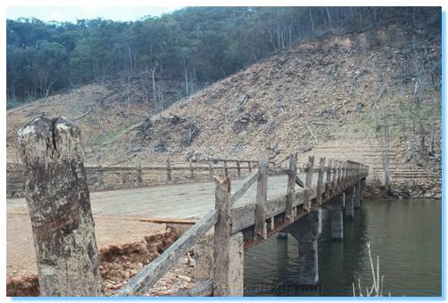
I eventually found what could possibly be a track heading off down the side of the ridge.  Further exploration showed it was a track, though not one that had been used in a very long time.  Following the track using best guesses at some times, I came out at a cleared area, and could see the Darlingford Bridge. I walked along what must have been the main road of the town; a few signs of where buildings once stood, such as the remains of chimneys and rusting iron were seen amongst the dead trees.


I walked out along the Darlingford Bridge, which on crossing the Big River was blocked by a landslip.  The road could be seen in parts continuing to the left, North along the slope.
I walked back through the remains of the town, and could see fence posts, an old water tank tower, more chimney remains and an old bed!
I also found what might have been an old shed; a simple frame of tree branches with old shoes lined up inside!  Out the back of the frame was part of an old engine block, which looked like it was originally hooked up to a belt but I couldn't see what it might have been used for.
Here's a web page I found with a number of photos also of the Darlingford town. 

Sunday, 9 February 2003

Camping at Upper Yarra Reservoir Park

Participants:

Mark, Russell & Stephanie

Fot, Marisol & Jacqui

Wendy & Rachael

Henric & Annaleigh

Mark, Michelle, James, Liam & Shannon

Friday, 7th February 2003

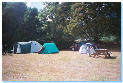
We arrived at the campground to find Mark, Russell and Stephanie finishing off their BBQ dinner.  We set up our tent before it got dark, and joined them in a game of cards.  We went for a night walk around the Fern Gully Walking Trail.  We heard the odd bit of wildlife in the dark, which was quite spooky but didn't spot anything with our torches except for an eel in the river beneath the bridge, with blue pectoral fins.  Back to camp and a not too late night.  Steph put some of the other campers straight about their fire (The High Country was still well alight) and we all went off to sleep.  Those without ear plugs were woken through the early morning by some very loud bird sounds, almost like a siren.  No idea what bird it was, perhaps a White-Bellied Sea Eagle?????

Saturday, 8th February 2003


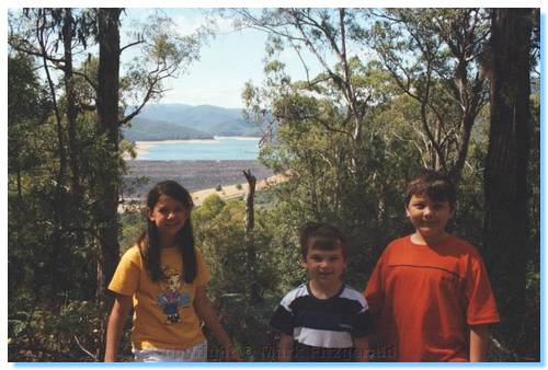
Mark, Russ, Steph, myself, James, Liam and Shannon decided to walk up the Doctors Creek Walking Track to check out the lookout after our huge bacon and egg breakfast.  Michelle waited at the campsite in case the others arrived.  We passed the McVeigh's Waterwheel, which has a history of providing power for an old mine now under the waters of the Upper Yarra Reservoir, as well as power for an old hotel, also I believe under the waters.  We passed along the Yarra River for a short while before beginning our ascent.  Liam soon found it a bit of a struggle, but eventually we all made it to the top. 


We soaked up the view, reported back to Michelle over the UHF, and made out way back to camp to await the rest of our camping party to arrive.  Mark, Russell and Steph found the heat was getting too much so decided to head down the valley into Warburton.


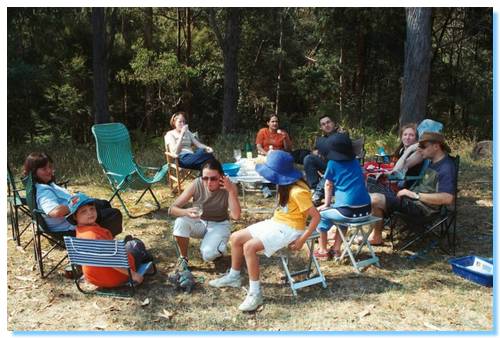
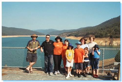
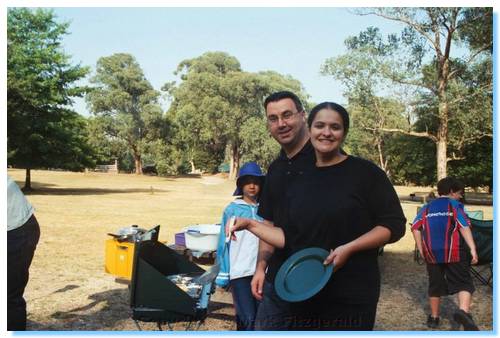
About 1:00, everybody else arrived.  First time campers Fot and Marisol managed to get their Taj Mahal tent up like they were old pros.  Henric & Annaleigh brought their new family additions along; two beautiful Russian Blue kittens, which kept the kids very well entertained.


The day was hotting up and we chased the shade through the afternoon, enjoyed a game of cricket, had a goanna attempt to get into our tent and explored the dam lookout and spillway.  All the while Yellow-Tail Black Cockatoos and King Parrots kept us company.
We started on the pre dinner nibblies such as Double Brie, Yabby Pate and anti pasto and enjoyed some very good company before beginning our almighty smorgasbord feast of chicken fajitas, lamb casserole, spanakopitas, and quiche.  We went for a night drive through the park to see what we could spot, and found a number of deer as well as a wombat.  We returned to camp for dessert, having fruit salad as well as pancakes, berries and ice cream.  Oh, and Steph had to go and sort those other campers out again who had no idea about fire safety...

Sunday, 9th February 2003


We all cooked up another magnificent Bacon & Egg Breakfast and ate ourselves stupid before packing up the tents and preparing to head off.  Stephanie had arranged a massage in Warburton, so Mark & Russel took her in and dropped her off before meeting us all as we drove up into the forest to visit the Ada Tree.  We all managed to see a snake basking on the road before it moved off into the bush; we were not able to identify what type of snake it was, possibly an Eastern Brown.
At the Ada Tree carpark, Henric and Annaleigh said their farewells as they had to get back home early.
We all took the beautiful walk along Island Creek which brought us along a cool trail that closely followed the crystal clear creek through a ferny subtropical valley, and past the remnants of some huge mountain ash trees.  Some evidence of the timber industry of a century ago remained, such as some rotting sleepers along the trail, and some notched tree stumps.  We soon wound our way up and out of the valley and arrived at the Ada Tree, a huge Mountain Ash.  This tree is probably the largest hardwood tree in the world.  It is approximately 76 metres tall.  Not as tall as the California Redwoods, or even in fact the Big Tree near Marysville at 84 metres, but with a girth of over 15 metres at 2 metres above the ground it is estimated to weigh more than 1100 tonnes.  Before it lost its crown in a storm it may have been 120 metres tall, making it the tallest tree in the world.  A similar Mountain Ash living in Gippsland was cut down to measure its length (yeah, go figure) and was measured at 114.3 metres long.  Yes, Australia has the worlds longest log.
After walking back to the cars, we drove into Warburton via Starlings Gap and Big pats Creek.  We sat down by the side of the Yarra and finished off the rest of the quiche, whilst the kids managed to all fall into the river.  We all said our goodbyes before making our separate ways back home.  Thanks all for a great weekend!

Wednesday, 1 January 2003

La Trobe River revisited

I wanted to revisit this area and follow the trip notes in the book, so I packed up my two sons and headed off on New Years Day.  Again there was nobody else camping in the whole forest, and we only came across the odd car and trail bike rider.
We travelled in from Neerim South, and saw some Jersey cows which we stopped to feed.  We continued along the trip notes, and found a nice little camp site on H-Tree Extension, though the river that flowed through nearby hadn't seen water for quite some time.


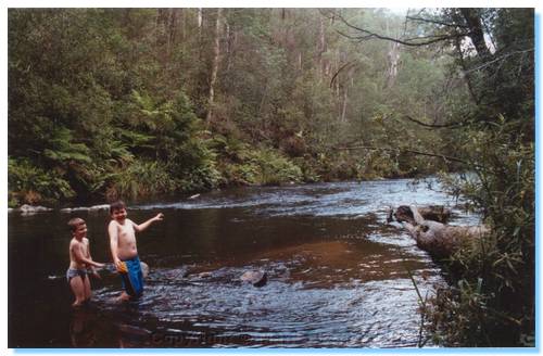
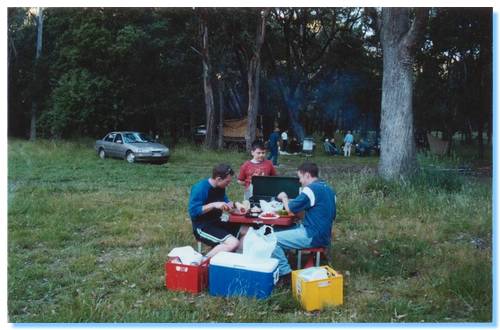
We soon arrived at the campsite near Hawthorn Bridge that I discovered on the previous trip, and setup camp while the kids enjoyed a swim in the river.  There were a few March Flies around, one of which chased James and Liam in circles around the picnic table, but they soon disappeared as the evening became cooler.
We cooked and ate our dinner, and settled down to play some games when it started to drizzle, so we moved into the tent as the rain started.

The next day we explored around a little, before packing up and heading off to explore wider.  We crossed Hawthorn Bridge, and headed North into Noojee State Forest along a track unnamed on my map.  We explored a side track that came back down near the north shore of the La Trobe, but the track was overgrown and became impassable near the bottom, so we backtracked and continued along the ridge.  A number of side tracks which according to the map went back down to Hawthorn Creek Road could not be found, so we continued on until we reached Suckling Road, which took us down through some rutted track to Hawthorn Creek Road which I planned to follow out.  Surprisingly, the bridge was out so after a review of the maps, we drove back up Suckling Creek Road a short distance, taking the first track on the right which we followed up the ridge to Vesper Road, and onto Mount Baw Baw Tourist Road.

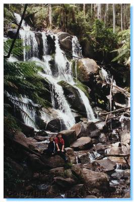
We then drove up to Toorongo Falls, which were flowing well with the help of the rain overnight.  After our walk to the falls, we drove up Fawcett Track, which was overgrown at some points but came out on some really nice clear tracks which took us down to Loch Valley Road, which we followed on out to Noojee and home.

Aussie Trips 2003

Rocky track, Toolangi
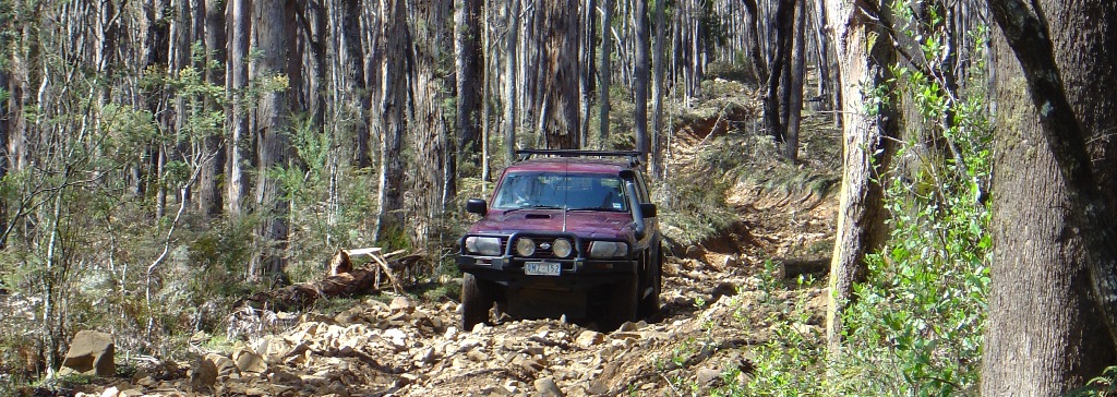
Another great year exploring around Victoria, including heading from the far North West to the Far North East over a two week period. Travelling on the desert sands of Wyperfeld one week, then amongst the snow of the High Country the next was unforgettable.

Monday, 16 December 2002

La Trobe River State Forest

The first trip intended to follow the set route in the reverse order.  Willowgrove Road is a beautiful windy drive through the forest, but we had a bit of trouble finding the Kings Rd turnoff, driving right past it for some distance before returning and using the GPS to locate it.  Kings Road brought us down to Hawthorn Bridge, reportedly closed but it seemed in OK condition and didn't collapse on us.  There was a really clean and new toilet built here and lots of possible camp sites, so we setup camp and tried some fishing before cooking a succulent chicken in the camp oven and relaxing around the fire.
Later in the evening as we were enjoying the quite and solitude, we could see two possums climbing out on a tree branch silhouetted against the moonlight sky high overhead.  It seemed strange for them to be climbing along the dead branch towards the edge, until one after the other they leaped off the branch into the air, spread their legs wide and floated down onto the trunk of another tree.  What a fantastic sight, our first observation of gliders in the bush.
Still later, we were startled as they one after the other crashed into the trunk of a tree just beside where we were sitting.  We were able to get a very good look at them and identified them as Greater Gliders, but I couldn't get the camera from the car before they had climbed up into the trees.
The next day we drove out along La Trobe River Road, finding another great campsite only accessible by 4WD.  I took a wrong turn missing H Tree Extension Road so we gave up on the planned route and just drove along, ending up on the Old Sale Road, and doing some 4WDing along Webbs Road along the back of farmland, eventually arriving into Neerim South via McDougals Rd.

Sunday, 1 December 2002

Rubicon Range Rover Club Trip

Saturday 30th November

Participants:

Russell
Mark L
Mark F & James

Morning Tea at Dudley Saddle
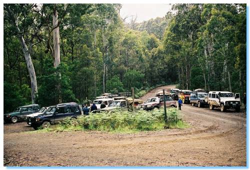
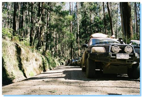
We all met at Marysville around 9:00 on a cool misty Melbourne morning.  After the run down from John on the plan and convey procedure, we were all soon off in convoy down the Marysville Woods Point Road to our first destination at Cambarville.  We did a quick drive around the loop here with commentary from John and continued on down Big River Road into Big River State Forest.  We made one wrong turn, but were soon at Weather Range Junction on Dudley Saddle for our morning tea stop.  I parked my car in the middle of the junction; one wheel off the dirt a little on some grass which seemed to attract a scornful look from another trip participant...  It was latter observed that this person had no compunctions in picking various flowers and leaves along our journeys, eventually laying to waste great tracts of once gorgeous bush, leaving nothing but smouldering stumps and scorched earth... Ok, slight exageration.

View when climbing Mt Torbrek
After some otherwise friendly chatting we were off again up Cold Weather Road, across Winch Hill and down Snobs Creek Road until we reached a deforested area.  From here we drove up Conn Gap Road, and then the slightly steeper, wetter and rockier Barnewall Plains Road.  We parked the cars on the plains near a treed picnic area, and a number of us made the climb up Mt Torbrek.

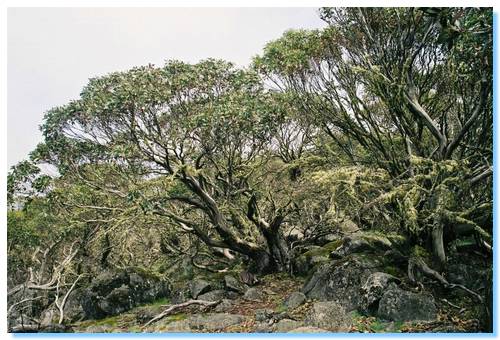
Trees on summit of Mt Torbrek
The view from the top of Mt Torbrek was fairly well obstructed by Alpine Gums, but there was a stone cairn which could be climbed to improve the views.

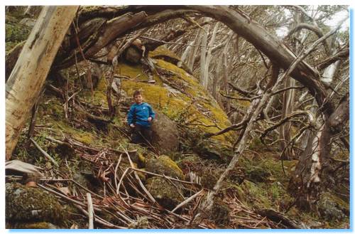
James amongst the boulders on Mt Torbrek
James did an excellent job climbing the mountain, and his Digimon even made it up and back to tell the tale.  On the trip back down some others managed to spot a snake, but it had slithered off before we had the chance to see it.
We returned to where we had parked the cars for a lunch break and some more chatting with our friendly trip participants.  Mark managed to find somebody from South America to practice his Spanish on!

Snobs Creek Falls
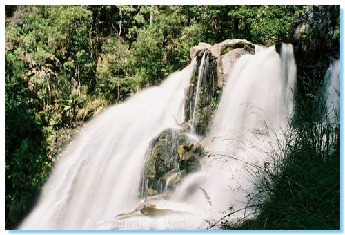
We backtracked onto Snobs Creek Road and stopped to see Snobs Creek Falls, which were flowing very well thanks to the recent rains we had had.

View from Morris Lookout towards Eildon
Backtracking again, we ascended Herbs Road past some girls bushwalking and drove up to Morris Lookout, which had views over to Eildon Dam and Pondage.  We relaxed here a bit and had our afternoon tea.  It wasn't at 4:00 though, according to my English friends....

How are those Chicken Fajitas coming along????
We continued on down Herbs Road into Rubicon, and then onto our Campsite at Kendall's A.  The grass was quite long, which didn't agree with my hay fever but it was a lovely spacious campsite that we could all spread out in quite nicely.
The tent was soon set up, and after a quick game with the Frisbee it was time to start cooking dinner.

Sunday 1st December 2002

Old boiler at Clarke & Pierce #4 Mill
We awoke early to the most magnificent cacophony of birds, ate breakfast, packed up camp and were soon on the road again.  Today was power station day...
We stopped off at Rubicon Power Station where we could see a Pelton Wheel on display, and the generators inside the station.  Water was diverted from various dams down aqueducts and pipe lines into the station to generate electricity for Eildon and the surrounding area.
We drove up Royston River Road to Royston Dam where the aqueduct starts from below the dam wall.
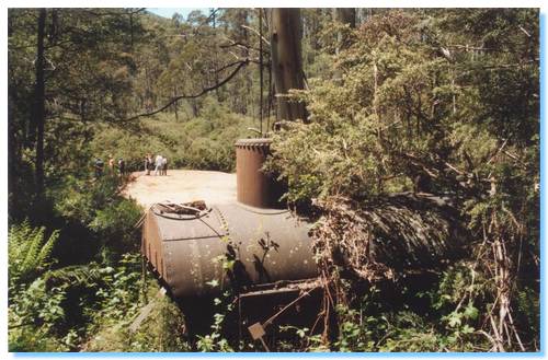
We then continued up to Clarke Pierce # 4 Mill site, where we spotted an old boiler and a huge sawdust mound.  We had lunch here on the banks of the Royston River before continuing on.

Parked on the road looking at ANOTHER powerstation
View from the siphon across the trestle bridge
We backtracked to Rubicon River Road and visited another power station, visible from the road.  Various tramways and aqueducts could also be seen that service the station.  We continued down the road past a siphon, where the aqueduct ran through a tunnel which dropped down 5 or so metres to pass under a creek bed, and then came gushing up on the other side.  A rickety old trestle bridge carried the tramway across the creek bed, and we drove on down and under the bridge.
Continuing on down the road took as past Rubicon Falls, and yet another Power Station.  A little further on down the road and we were back at our first Power Station, completing the circuit.  We finished the Power Station tours with a quick trip down to another power station, and then to the switching stations, where one of our group managed to get himself bogged in the gutter on the roadside.

James exploring Keppel Hut
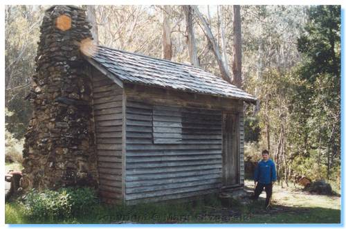
We then drove up Blue Range Road which has beautiful views into the valley and across the Cathedral.  We continued along MacFadyen Track to Keppel Hut for afternoon tea.  I'm pretty sure we missed the 4 o'clock deadline again today.
From here we made our way down onto Lady Talbot Drive, and back into Marysville and onto home.